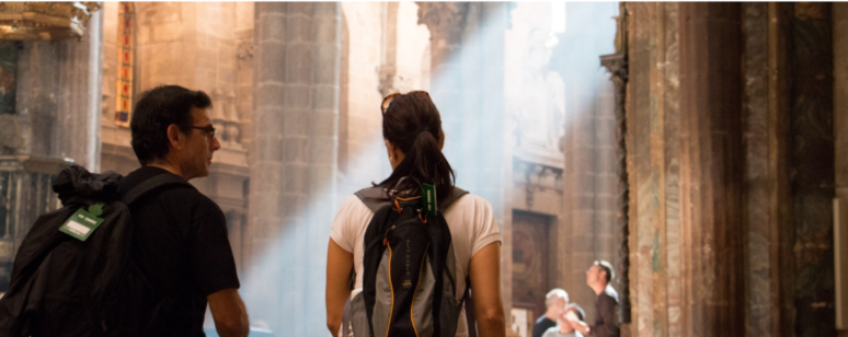
36 Nights on the Camino de Santiago: A Journey of Self-Discovery
Steps to the Soul
Price Per Person
Starting at TWD 186,000
Category
The Camino de Santiago – 780 km of self-discovery. A transformative journey to reconnect with your inner self, rediscover life’s true meaning, and restore a healthy, abundant body and mind. You can also choose the 115 km “Camino de Santiago Highlights – 7 Nights” for a shorter yet equally meaningful experience.

STAY
- 36 nights with breakfast included
- 35 nights with dinner included

Trip Services
- Daily luggage transfer service (one suitcase per person, up to 20 kg)
- Itinerary and documentation services (including Pilgrim Passport, Compostela Certificate, route planning, maps, guidebook, etc.)

Others
- Travel document holder
- Travel consultation service
- Travel Insurance:
- NTD 3,000,000 overseas travel accident coverage
- NTD 1,500,000 accident medical reimbursement
- NTD 1,000,000 emergency assistance
(Valid only for departures from Taiwan)
- Liability Insurance:
- NTD 5,000,000 accident coverage
- NTD 200,000 medical coverage
(Valid only for departures from Taiwan)
- Travel Inconvenience Insurance:
- “Value Plan” by Chubb Insurance — covers flight delays, baggage delays, etc.
- Option to upgrade to the Premium Plan at additional cost
- European mobile data plan
Trip Rules
2026 Price Information
- Twin Sharing: From NTD 186,000 per person
- Single Traveler: From NTD 252,000 per person
- Travel Period: March 15 – October 15, 2026
Please note:
- During peak seasons or exhibition periods, hotel prices may vary and are subject to the actual rates at the time of booking.
- Prices do not include airfare, passport or visa fees, and city taxes.
- Full payment (100%) is required two months prior to departure, and the tour is non-refundable and non-changeable once paid.
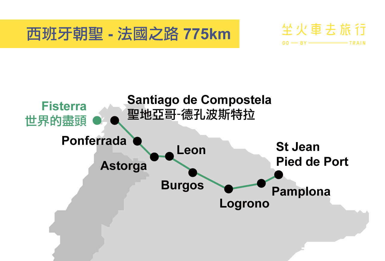
Trip Map
Detailed Itinerary
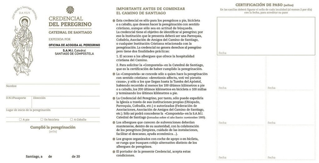
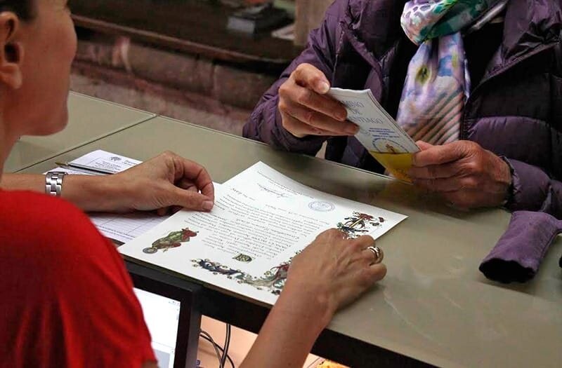
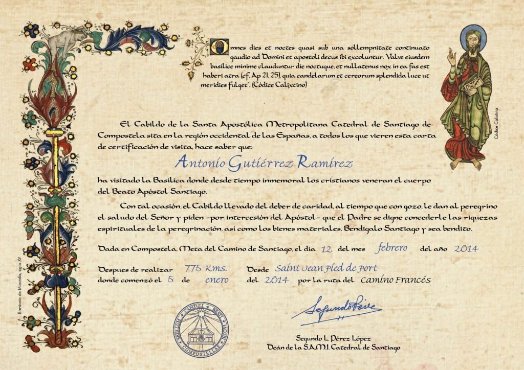
Pilgrim’s Passport & Compostela Certificate
- Before your departure, we will help you obtain the Pilgrim’s Passport (Credencial del Peregrino).
This passport includes your starting point, pilgrim’s name, passport number, address, and your chosen mode of pilgrimage (walking, horseback, or cycling). - Along the Camino, you can collect stamps in your passport from various places such as cafés, restaurants, hostels, and churches. Once you have gathered enough stamps, you can present the passport at the Pilgrim’s Office near the Cathedral of Santiago de Compostela to receive your Compostela Certificate, which is issued free of charge.
- According to tradition, those who obtain this certificate will have half of their worldly sins forgiven after death. Of course, this belief is optional—some pilgrims choose not to use the passport at all.
- You may also choose to pay €3 to receive an additional “Certificate of Distance”, issued by the Cathedral of Santiago. This document officially states the total kilometers you have traveled.
- Since the Compostela and pilgrim services are offered entirely free of charge, the sale of the distance certificates helps support the continued operation of the Pilgrim’s Office and related services.
If you decide to continue walking beyond Santiago to Finisterre (or Fisterra)—once believed to be “the end of the world” before the discovery of the Americas—you can receive another certificate upon completion of this final route.
Please note that the Pilgrim’s Office carefully checks the stamps along your route; those who travel to Finisterre by bus or other transport instead of walking will not be eligible for the certificate.Pilgrim passport
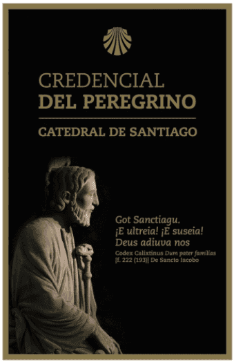
Claim the certificate with your Pilgrim’s Passport
Distance Certificate (available for an additional €3)
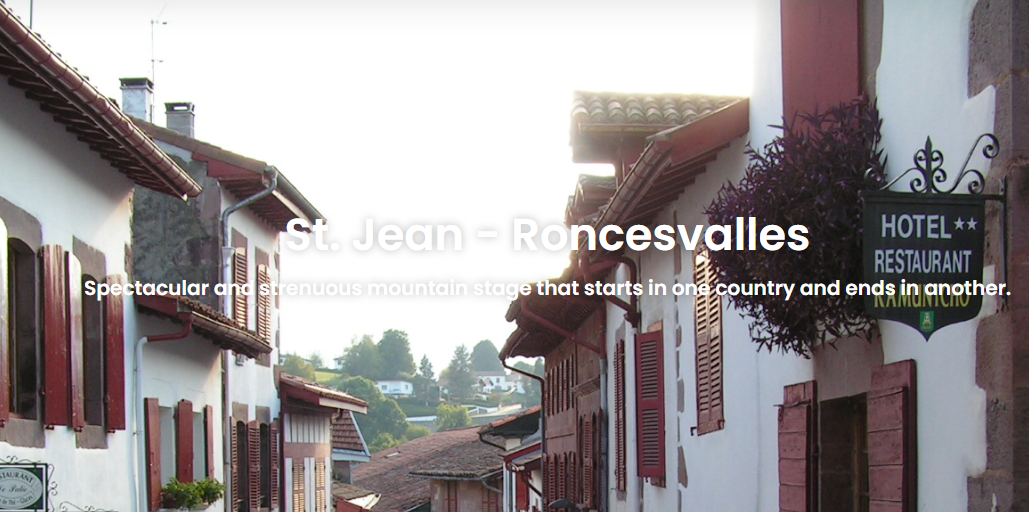
Day 1 | Arrival in St. Jean Pied de Port / Overnight in St. Jean Pied de Port
- The starting point of The French Way is in St-Jean-Pied-de-Port, France.
- The first section follows the famous Route Napoléon, which continues across the Roncesvalles Pass into Spain.
- Tonight, you’ll stay at a local hotel to rest and prepare for the 36-day journey of self-discovery along the Camino de Santiago that begins tomorrow.
At your first hotel, you will receive the following materials we have prepared for you:
– Pilgrim’s Passport (Credencial)
– Luggage Tag
– Camino Map and Major City Guide
– Latest Local Travel Information
– Travel Notebook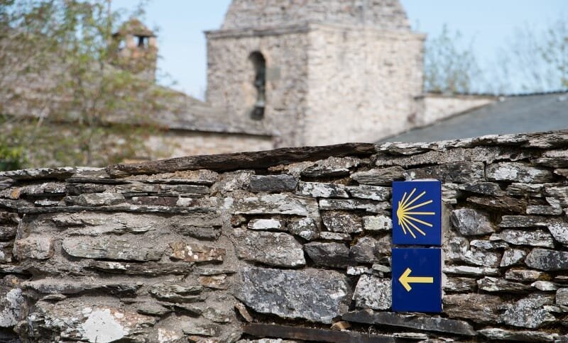
Day 2 | St Jean Pied de Port – Roncesvalles / Overnight Roncesvalles
Begin your pilgrimage by crossing the Pyrenees via the famous Route Napoléon. Enjoy stunning mountain views and fresh air as you walk from France into Spain, ending the day in the historic village of Roncesvalles.

Today's Overview
- Route Difficulty: Hard
- Walking Distance: 24.3 km
- Walking Time: 7 hours 30 minutes
- Total Ascent: 2,348 m
- Total Descent: 1,590 m

Recommended Route Stages
St Jean Pied De Port - Orisson 7.5 km
Orisson - Roncesvalles 16.8 km
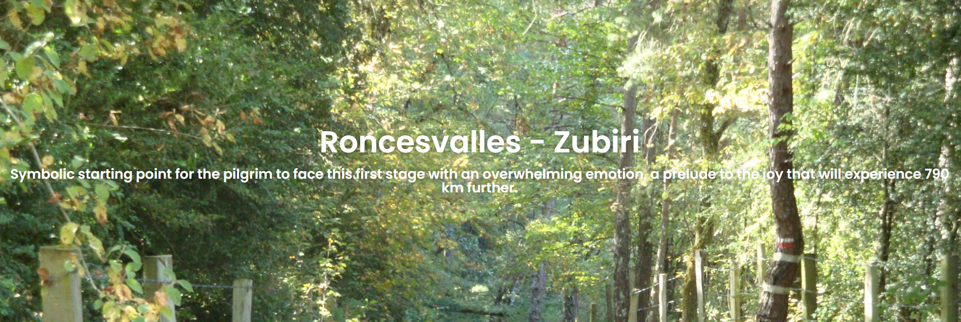
Day 3 | Roncesvalles – Akerreta / Overnight Akerreta or Zubiri
Walk through peaceful woodland paths and charming Basque villages as you descend from the Pyrenees. The route offers a mix of forest trails and gentle countryside roads, leading you to the quiet rural village of Akerreta—famous for its traditional stone houses and serene atmosphere.

Today's Overview
- Route Difficulty: Hard
- Walking Distance: 21.46 km
- Walking Time: 5 hours 10 minutes
- Total Ascent: 340 m
- Total Descent: 754 m

Recommended Route Stages
- Roncesvalles - Viscarret 13.2 km
- Viscarret - Zubiri 8.2 km
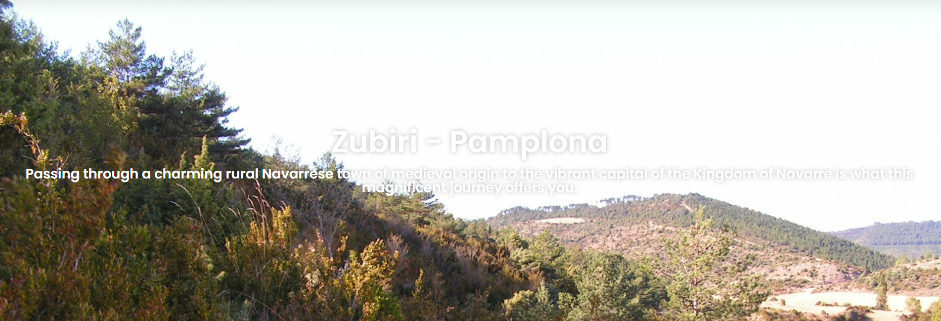
Day 4 | Akerreta – Pamplona / Overnight Pamplona
Pamplona is the host city of Spain’s famous Running of the Bulls, part of the San Fermín Festival, held annually from July 6 to July 14. The festival dates back to the 12th century, originally created to honor Saint Fermín, the city’s founder and patron saint. Over time, the celebration evolved from a purely religious event into a lively cultural festival filled with speeches, concerts, competitions, and bullfights, later adding fireworks and dance performances. The bull run (Encierro) itself began in the 17th century, when locals and visitors alike started participating together.
The festival gained international fame in 1926, after American author Ernest Hemingway published his novel The Sun Also Rises. The story follows a group of American and British expatriates traveling from Paris to Pamplona to witness the San Fermín Festival’s bull runs and bullfights, captivating readers worldwide and inspiring travelers to join the celebration.
The most iconic event, the Running of the Bulls (Encierros), takes place every morning at 8 a.m. from July 7 onward. Participants dress in white clothing with a red scarf and red waistband, carrying rolled-up newspapers to help guide the bulls. The event begins when six bulls are released from their pens, charging through 820 meters of narrow cobblestone streets toward the bullring. The bulls can reach speeds of up to 24 km/h, making the entire run last only 3 to 4 minutes. Once the bulls arrive at the arena, fireworks are launched to signal the end of the run and the start of the afternoon bullfights.

Today's Overview
- Route Difficulty: Moderate
- Walking Distance: 20.43 km
- Walking Time: 5 hours
- Total Ascent: 299 m
- Total Descent: 371 m

Recommended Route Stages
- Zubiri - Akerreta 6 km
- Akerreta - Zabaldika 6.6 km
- Zabaldika - Pamplona 7.8 km
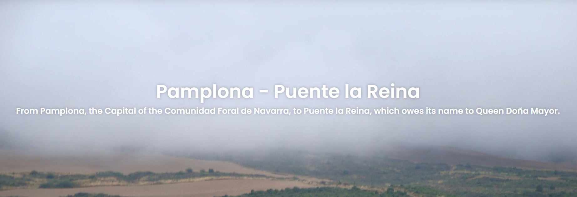
Day 5 | Pamplona – Puente la Reina / Overnight Puente la Reina
Today’s route takes you out of the lively city of Pamplona and into the scenic countryside of Navarre, passing through gentle hills and olive groves. Along the way, you’ll reach the famous Alto del Perdón — the “Hill of Forgiveness” — marked by a striking metal sculpture of pilgrims symbolizing faith and perseverance. From the top, you’ll enjoy sweeping views of Pamplona and the vast valley ahead.
The trail then descends gradually toward the historic town of Puente la Reina, named after the beautiful Romanesque stone bridge built by a queen in the 11th century. This town marks the point where several Camino routes from France converge, making it a key meeting place for pilgrims. You’ll spend the night here, immersed in the warm and communal spirit of the Camino.

Today's Overview
- Route Difficulty: Moderate
- Walking Distance: 24.09 km
- Walking Time: 6 hours
- Total Ascent: 582 m
- Total Descent: 691 m

Recommended Route Stages
- Pamplona - Cizur Menor 4.8 km
- Cizur Menor - Cizur Mayor 1.2 km
- Cizur Mayor - Zariquiegui 4.8 km
- Zariquiegui - Alto Del Perdon 2.4 km
- Alto Del Perdon - Uterga 3.3 km
- Uterga - Muruzabal 2.4 km
- Muruzabal - Obanos 1.6 km
- Obanos - Puente La Reina 3.6 km
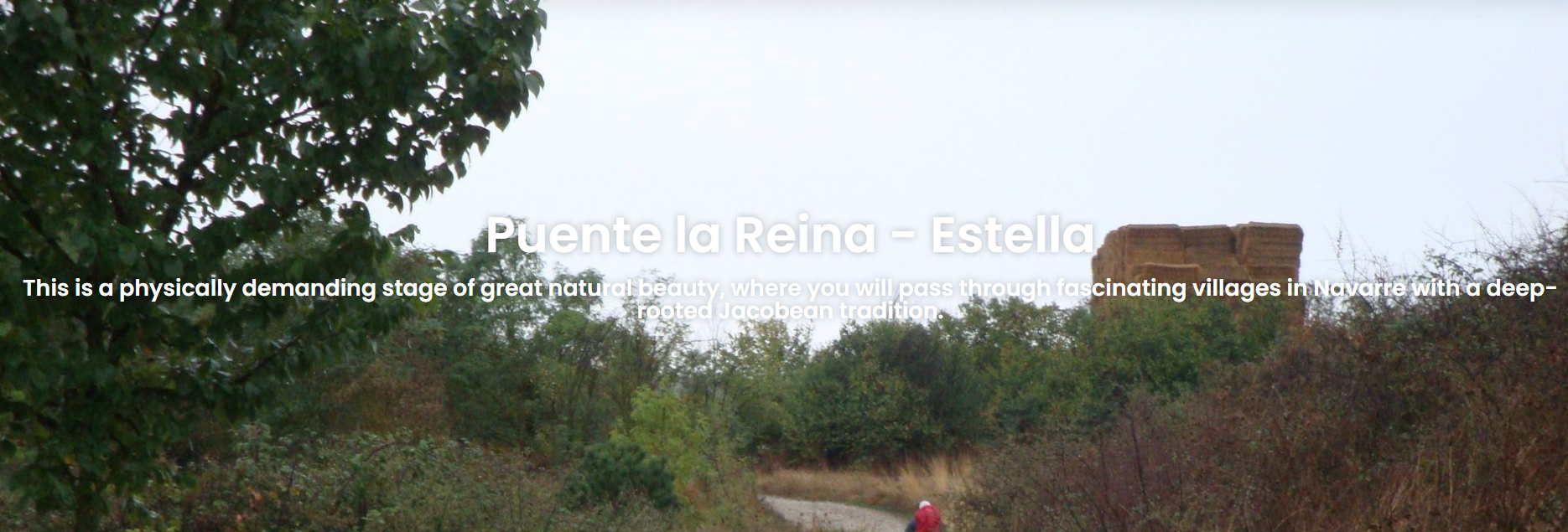
Day 6 | Puente la Reina – Estella / Overnight Estella
This stage begins by crossing the ancient stone bridge of Puente la Reina, built in the 11th century by Queen Doña Mayor to ensure the safe passage of pilgrims. The route passes through charming villages such as Cirauqui and Lorca, both rich with Roman ruins and medieval stone architecture that evoke the spirit of the old pilgrimage days.
The path is relatively gentle, winding through vast vineyards and olive groves—perfect for a peaceful day of walking. The stage ends in Estella, known as “The City of Gold,” a beautiful historic town that blends religion, art, and culture, making it one of the most captivating stops along the Camino.

Today's Overview
- Route Difficulty: Moderate
- Walking Distance: 21.6 km
- Walking Time: 5 hours 24 minutes
- Total Ascent: 442 m
- Total Descent: 360 m

Recommended Route Stages
- Puente La Reina - Lorca 12.6 km
- Lorca - Estella 9.5 km
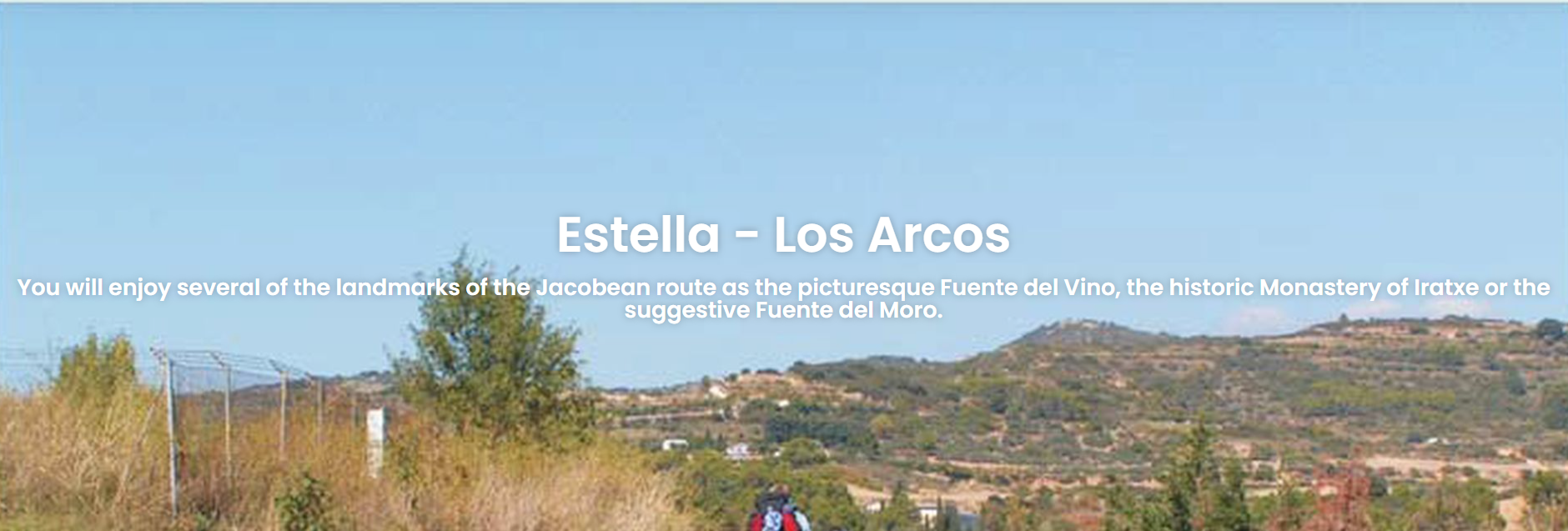
Day 7 | Estella – Los Arcos / Overnight Los Arcos
This stage begins in the historic town of Estella, passing through lush vineyards and olive groves. It is considered one of the most scenic and charming stretches of the French Way, offering a quintessential taste of the Spanish countryside. Although the terrain is mostly gentle with few steep climbs, the path is quite exposed to the sun, so it’s best to start early to avoid the afternoon heat.

Today's Overview
- Route Difficulty: Moderate
- Walking Distance: 21.52 km
- Estimated Walking Time: 5 hours 30 minutes
- Total Ascent: 551 m
- Total Descent: 523 m

Recommended Route Stages
- Estella - Irache 3.8 km
- Irache - Azqueta 3.5 km
- Azqueta - Villamayor de Monjardin 1.9 km
- Villamayor de Monjardin - Los Arcos 12.6 km
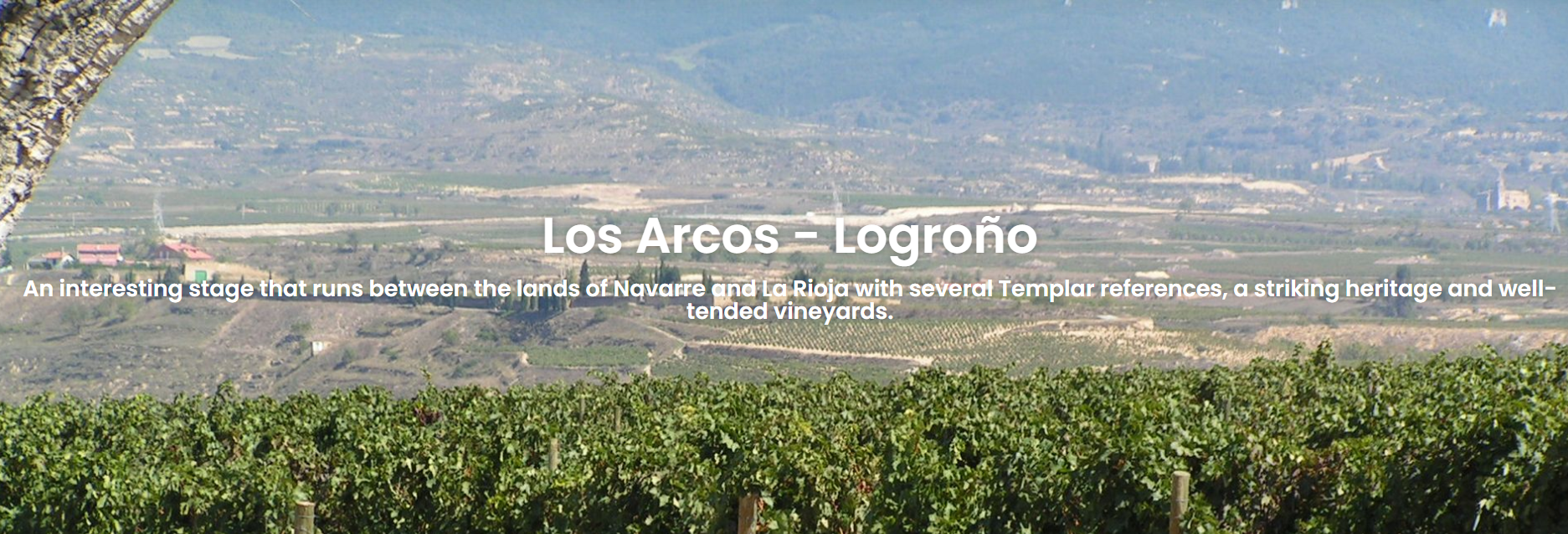
Day 8 | Los Arcos – Logroño / Overnight Logroño
This stage is relatively long, beginning in the peaceful town of Los Arcos and ending in the vibrant city of Logroño — the capital of the La Rioja region and Spain’s renowned wine capital. This route marks the symbolic crossing from the Navarra region into the Rioja wine country, offering beautiful views of vast vineyards and gently rolling hills along the way.

Today's Overview
- Route Difficulty: Moderate
- Walking Distance: 27.62 km
- Estimated Walking Time: 7 hours
- Total Ascent: 601 m
- Total Descent: 667 m

Recommended Route Stages
- Los Arcos - Torres Del Rio 7.7 km
- Torres Del Rio - Viana 10 km
- Viana - Logrono 10.5 km
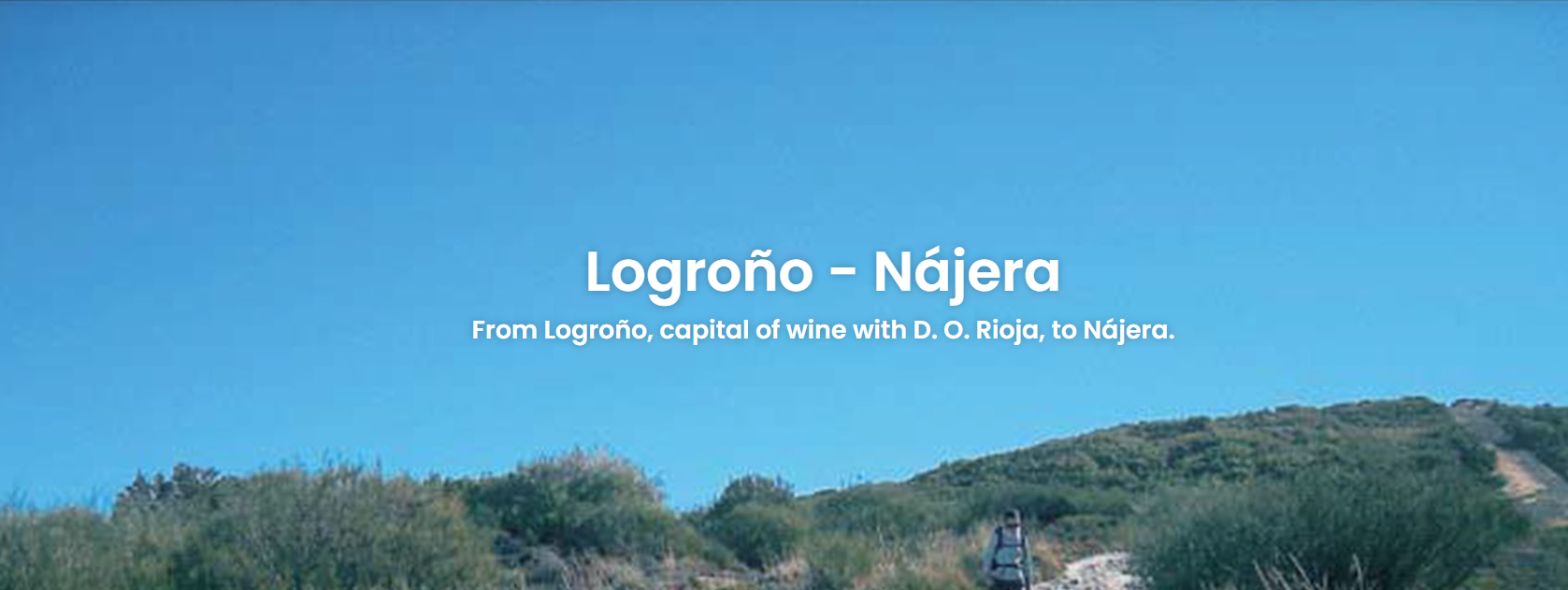
Day 9 | Logroño – Nájera / Overnight Najera
This stage begins in the bustling city of Logroño and leads through the very heart of the La Rioja wine region, ending in the historic town of Nájera, nestled beneath striking red cliffs. Along the way, pilgrims are treated to endless vineyards, gentle rolling hills, and distant mountain views—making this one of the most classic and emblematic “wine routes” on the French Way.

Today's Overview
- Route Difficulty: Difficult
- Walking Distance: 28.8 km
- Estimated Walking Time: 7 hours 30 minutes
- Total Ascent: 517 m
- Total Descent: 411 m

Recommended Route Stages
- Logrono - Embalse De La Grajera 5.4 km
- Embalse de la Grajera - Navarrete 6.3 km
- Navarrete - Ventosa 6.8 km
- Ventosa - Alto De San Anton 2.1 km
- Alto De San Anton - Najera 8.2 km
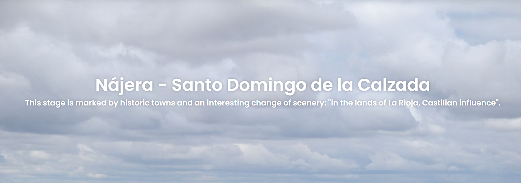
Day 10 | Nájera – Santo Domingo / Overnight Santo Domingo
This stage is not particularly long but features a gradual uphill climb throughout the day. Departing from Nájera, the route steadily ascends toward the high plains of La Rioja, passing through vast vineyards, golden wheat fields, and open skies. The scenery is simple yet peaceful, offering a glimpse of the authentic rural heart of inland Spain. This stage symbolizes the transition from the lush wine country to the expansive plateau, allowing pilgrims to slow down and settle into the steady rhythm of the Camino once again.

Today's Overview
- Route Difficulty: Moderate
- Walking Distance: 20.88 km
- Estimated Walking Time: 6 hours
- Total Ascent: 445 m
- Total Descent: 293 m

Recommended Route Stages
- Najera - Azofra 5.7 km
- Azofra - Ciruena 9 km
- Ciruena - Santo Domingo De La Calzada 6.1 km
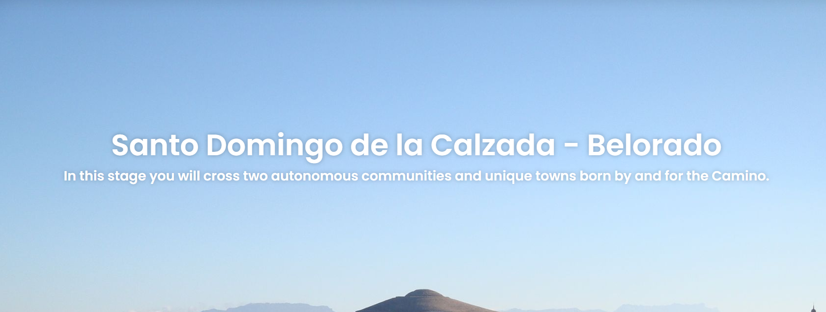
Day 11 | Santo Domingo – Belorado /Overnight Belorado
This stage is gentle and pleasant, beginning in the historic town of Santo Domingo de la Calzada and following rural paths through vast farmlands and fields of golden wheat. The route gradually leads into the region of Castilla y León, marking the official departure from La Rioja. It is an important transition day on the Camino, as the landscape and culture shift from the lush vineyards of the wine country to the open plains and pastoral scenery of the Spanish highlands.

Today's Overview
- Route Difficulty: Moderate
- Walking Distance: 22.09 km
- Estimated Walking Time: 6 hours
- Total Ascent: 413 m
- Total Descent: 292 m

Recommended Route Stages
- Santo Domingo De La Calzada - Redecilla Del Camino 11.3 km
- Redecilla Del Camino - Belorado 11.7 km
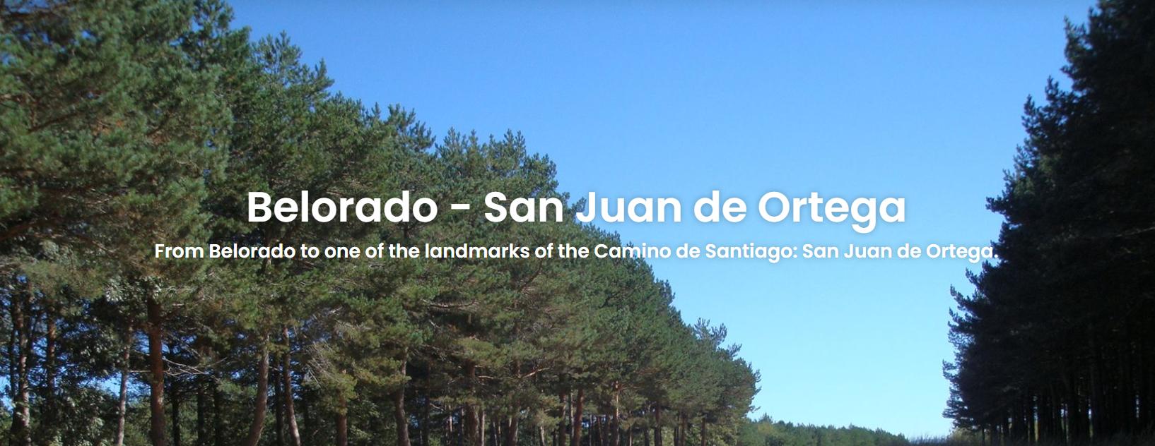
Day 12 | Belorado-San Juan de Ortega/Atapuerca / Overnight San Juan de Ortega/Atapuerca
This stage offers diverse scenery and is considered an important transition from the open plains to the foothills. Departing from Belorado, the route gradually leaves behind the vast farmlands and enters wooded areas and gentle hills, with more shade and forest paths along the way. It also marks the approach to the province of Burgos, where the terrain becomes more varied yet peaceful—inviting pilgrims to walk inward, both through nature and within themselves.

Today's Overview
- Route Difficulty: Moderate
- Walking Distance: 23.79 km
- Estimated Walking Time: 5 hours 56 minutes
- Total Ascent: 468 m
- Total Descent: 239 m

Recommended Route Stages
- Belorado - Villambistia 6.8 km
- Villambistia - Villafranca Montes De Oca 5.2 km
- Villafranca Montes De Oca - San Juan De Ortega 11.5 km
Day 13 | San Juan de Ortega/Atapuerca – Burgos / Overnight Burgos
This stage marks your arrival in the historic city of Burgos, one of the most anticipated destinations on the French Way. The first half of the route passes through rolling hills and small villages, while the latter part gradually transforms into an urban landscape—symbolizing the transition from the quiet of nature to the vibrancy of civilization.

Today's Overview
- Route Difficulty: Moderate
- Walking Distance: 26.74 km
- Estimated Walking Time: 6 hours 45 minutes
- Total Ascent: 194 m
- Total Descent: 332 m

Recommended Route Stages
- San Juan De Ortega - Atapuerca 6.3 km
- Atapuerca - Orbaneja Riopico 8.2 km
- Orbaneja Riopico - Burgos 11.7 km
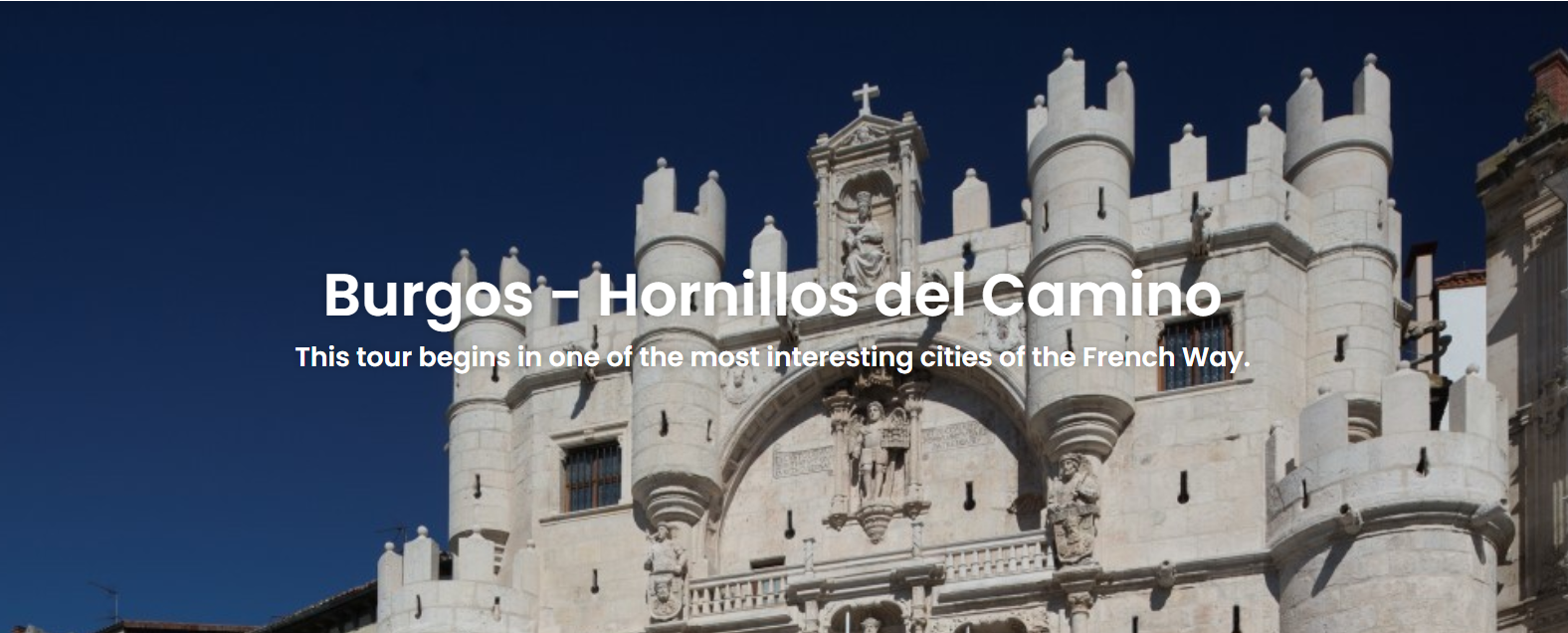
Day 14 | Burgos – Isar / Overnight Isar
This stage mainly passes through plains and gentle hills, marking a transition from the city into the quieter countryside. Departing from Burgos, the route follows wide paths through farmland and small villages, offering a soothing sense of leaving the urban bustle behind. Although this section is not long, it still showcases the characteristic landscapes of the Castilian plains, making it ideal for slowing your pace and enjoying nature and the morning breeze.

Today's Overview
- Route Difficulty: Easy
- Walking Distance: 22.31 km
- Estimated Walking Time: 4 hours
- Total Ascent: 753 m
- Total Descent: 857 m

Recommended Route Stages
- Burgos - Tardajos 11.8 km
- Tardajos - Hornillos Del Camino 10.5km
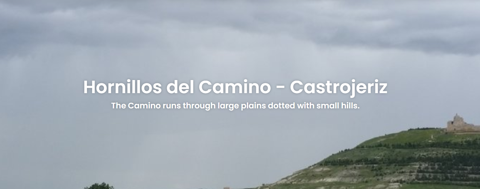
Day 15 | Isar – Castrojeriz / Overnight Castrojeriz
This stage begins along the historic route through the Castilian plains, where quaint villages and expansive fields alternate—a classic scene along the Camino de Santiago. Departing from Isar, the path is mostly flat with gentle slopes, ideal for a leisurely pace to enjoy the surrounding scenery as you gradually approach the ancient town of Castrojeriz.

Today's Overview
- Route Difficulty: Easy
- Walking Distance: 21 km
- Estimated Walking Time: 5 hours 20 minutes
- Total Ascent: 204 m
- Total Descent: 224 m

Recommended Route Stages
- Hornillos Del Camino - Hontanas 10.5 km
- Hontanas - Castrojeriz 10.5 km
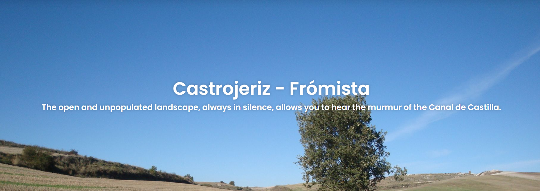
Day 16 | Castrojeriz – Frómista / Overnight Frómista
This stage crosses the plains and is one of the most classic long-distance walks across the Castilian fields. Departing from Castrojeriz, the route weaves through wide farmland and flat paths, allowing you to experience the endless fields and expansive skies. It’s a perfect section to slow your pace and fully savor the tranquility and natural beauty along the way.

Today's Overview
- Route Difficulty: Easy
- Walking Distance: 25.21 km
- Estimated Walking Time: 5 hours 40 minutes
- Total Ascent: 275 m
- Total Descent: 297 m

Recommended Route Stages
- Castrojeriz - Itero De La Vega 11.4 km
- Itero De La Vega - Fromista 13.8 km
Day 17 | Frómista – Carrión de los Condes / Overnight Carrión de los Condes
Today’s stage is peaceful and mostly flat, leading you through vast wheat fields and charming rural villages before reaching the historic town of Carrión de los Condes, known for its medieval atmosphere, ancient churches, and monasteries—a perfect place to experience the authentic spirit of rural Spain and the Camino.


Today's Overview
- Route Difficulty: Easy
- Walking Distance: 19.2 km
- Walking Time: 4 hours
- Total Ascent: 132 m
- Total Descent: 78 m

Recommended Route Stages
- Fromista - Revenga De Campos 7.6 km
- Revenga De Campos - Carrion de los condes 11.6 km
Day18 Carrión de los Condes-Calzadilla de la Cueza / Overnight Calzadilla de la Cueza
Today’s route is long, straight, and tranquil, crossing the vast plains of the Meseta—one of the most iconic landscapes of the Camino. With few villages along the way, pilgrims walk in solitude surrounded by open skies and golden fields, offering a perfect opportunity for reflection and inner peace before reaching the quiet, historic village of Calzadilla de la Cueza.


Today's Overview
- Route Difficulty: Easy
- Walking Distance: 16.87 km
- Walking Time: 3 hours
- Total Ascent: 84 m
- Total Descent: 58 m

Recommended Route Stages
- Carrión de los Condes-Calzadilla de la Cueza 16.8 km
Day 19 | Calzadilla de la Cueza – Sahagún / Overnight Sahagún
Today’s stage continues across the wide-open landscapes of the Meseta, with golden wheat fields and endless skies accompanying your walk through peaceful villages such as Ledigos, Terradillos de los Templarios, and Moratinos, offering a glimpse into the simplicity of rural Spain. The day ends in the historic town of Sahagún, renowned for its Mudejar-style architecture and rich religious heritage—often called the “Heart of Castile” and a culturally significant stop along the Camino.


Today's Overview
- Route Difficulty: Easy
- Walking Distance: 22.92 km
- Walking Time: 4 hours 30 minutes
- Total Ascent: 179 m
- Total Descent: 224 m

Recommended Route Stages
- Calzadilla De La Cueza - Terradillos De Los Templarios 9.6 km
- Terradillos De Los Templarios - Sahagun 13.3 km
Day 20 | Sahagún – El Burgo Ranero / Overnight Sahagún
Today’s stage is flat and straight, continuing across the open landscapes of the Meseta, with endless fields and wide skies stretching along the route. Pilgrims pass through the quiet village of Bercianos del Real Camino, experiencing the simplicity and charm of rural Spain, before reaching the peaceful and welcoming town of El Burgo Ranero, an ideal place to rest and recharge after a long day’s walk.


Today's Overview
- Route Difficulty: Moderate
- Walking Distance: 17.24 km
- Walking Time: 5 hours
- Total Ascent: 164 m
- Total Descent: 99 m

Recommended Route Stages
- Sahagun - Bercianos Del Real Camino 9.9 km
- Bercianos Del Real Camino - El Burgo Ranero 7.3 km
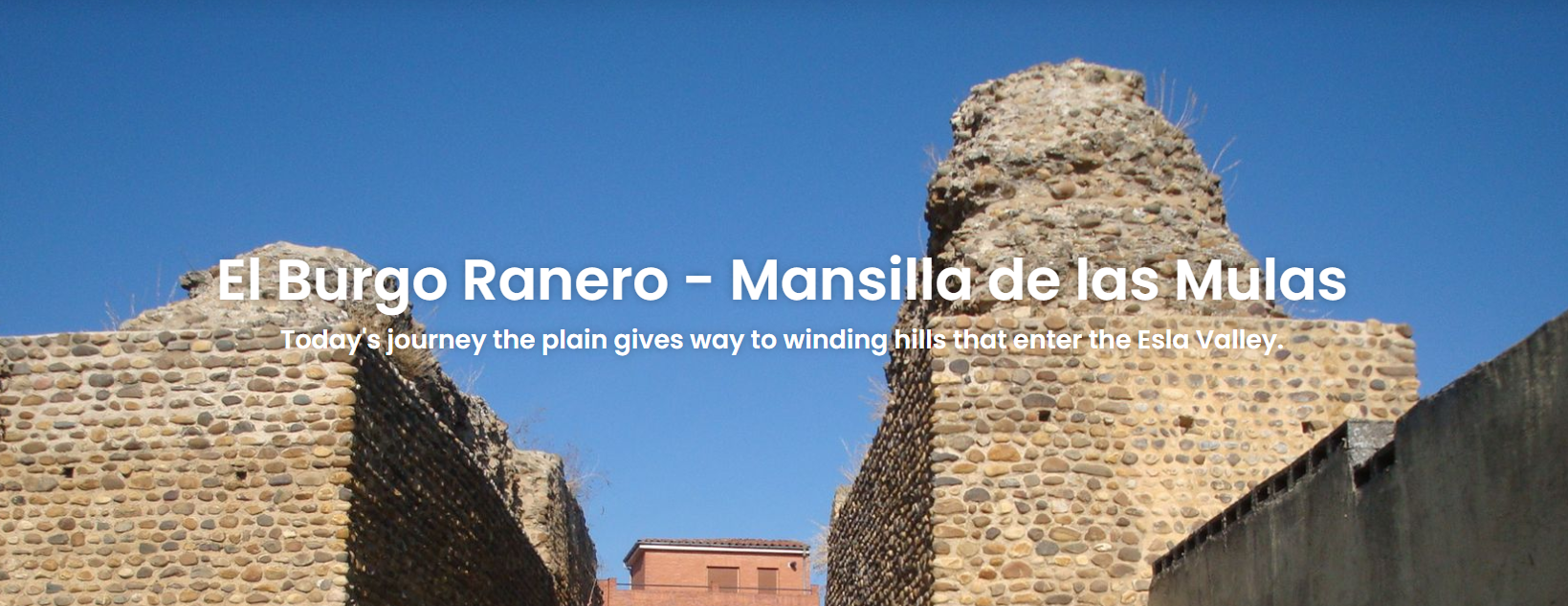
Day 21 | El Burgo Ranero – Mansilla de las Mulas / Overnight Mansilla de las Mulas
Today’s stage gently undulates across the Meseta, passing through quiet villages such as Villamoros de Mansilla, where pilgrims can experience the simple charm of rural Spain. The day concludes in the historic town of Mansilla de las Mulas, known for its ancient city gates and well-preserved architecture, serving as an ideal stop before entering the León region and preparing for the next stages of the Camino.

Today's Overview
- Route Difficulty: Moderate
- Walking Distance: 18.82 km
- Walking Time: 6 hours
- Total Ascent: 82 m
- Total Descent: 162 m

Recommended Route Stages
- El Burgo Ranero - Reliegos 11.7 km
- Reliegos - Mansilla De Las Mulas 7.1 km
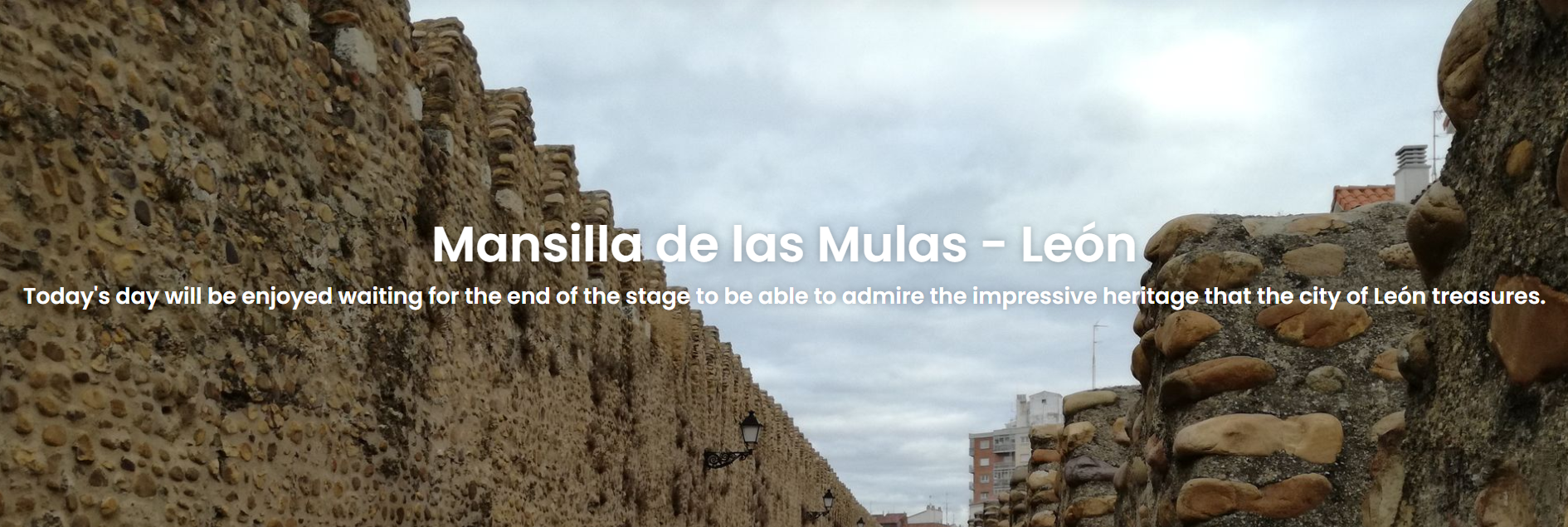
Day 22 | Mansilla de las Mulas – León / Overnight León
Today’s stage begins in Mansilla de las Mulas and follows the open landscapes of the Meseta, passing quiet fields and small villages that showcase the peacefulness of inland Spain. The day concludes in the historic city of León, renowned for its stunning stained-glass windows, Romanesque churches, and medieval streets—an ideal place for pilgrims to rest, explore history, and immerse themselves in culture and faith.

Today's Overview
- Route Difficulty: Easy
- Walking Distance: 18.66 km
- Walking Time: 4 hours
- Total Ascent: 246 m
- Total Descent: 207 m

Recommended Route Stages
- Mansilla De Las Mulas - Arcahueja 10.7 km
- Arcahueja - Leon 7.9 km
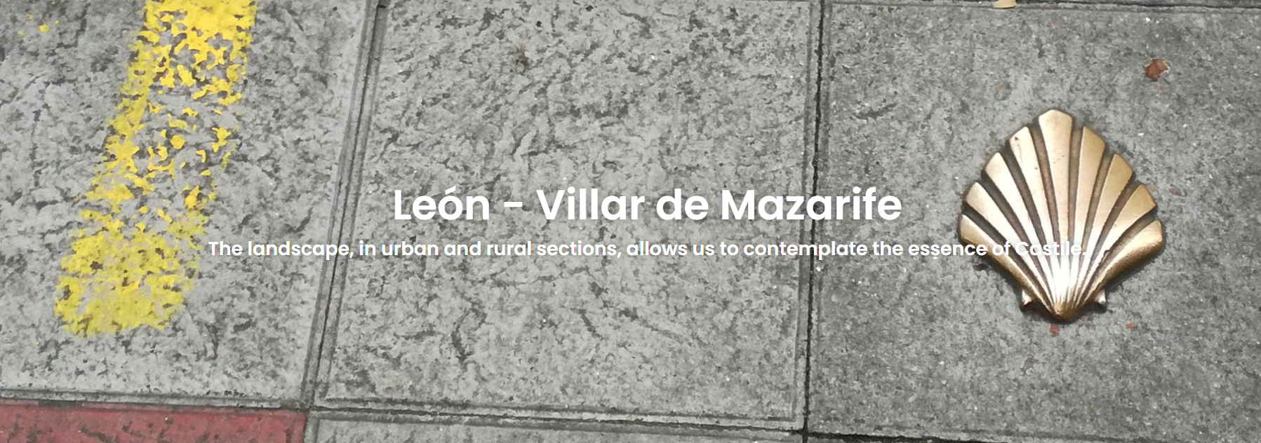
Day 23 | León – Villadangos del Páramo / Overnight Villadangos del Páramo
Today’s stage begins in the historic city of León and gradually leads out into the flat, open landscapes of the Meseta, with golden fields and quiet villages along the way. The day concludes in Villadangos del Páramo, a charming and welcoming village that preserves the simplicity of rural Spain—an ideal place for pilgrims to rest, recharge, and prepare for the next stage of their journey.

Today's Overview
- Route Difficulty: Easy
- Walking Distance: 20.72 km
- Walking Time: 6 hours
- Total Ascent: 254 m
- Total Descent: 910 m

Recommended Route Stages
- Leon - Oncina De La Valdoncina 10.7 km
- Oncina De La Valdoncina - Villar De Mazarife 10 km
Day 24 | Villadangos del Páramo – Astorga / Overnight Astorga
Today’s stage begins in Villadangos del Páramo, walking across the flat fields of the Meseta and passing quiet villages along the way. As pilgrims approach Astorga, the terrain gradually descends, revealing hills and the outline of the town. Upon arrival, they are greeted by a historic town that blends Roman remains with Gothic and Renaissance architecture, highlighted by the famous Episcopal Palace designed by Gaudí and the Astorga Cathedral, making it an ideal place to explore history, culture, and rest.


Today's Overview
- Route Difficulty: Hard
- Walking Distance: 30.69 km
- Walking Time: 7 hours 30 minutes
- Total Ascent: 238 m
- Total Descent: 251 m

Recommended Route Stages
- Villar De Mazarife - Hospital De Orbigo 14 km
- Hospital De Orbigo - Astorga 16 km
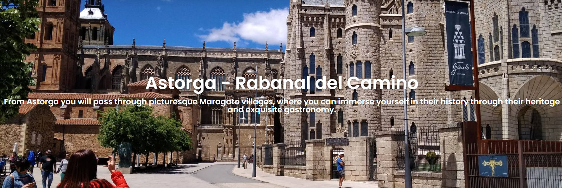
Day 25 | Astorga – Rabanal del Camino / Overnight Rabanal del Camino
Today’s stage begins in Astorga and is one of the longer, more challenging sections of the Camino, gradually leaving the flat Meseta fields behind and entering rolling hills. The scenery shifts from wide-open farmland to scattered forests and pastoral paths. Upon reaching Rabanal del Camino, pilgrims are welcomed by a charming village with traditional wooden buildings and a warm, pilgrim-friendly atmosphere, where local inns and cafés provide the perfect place to rest, refuel, and recover after a long day’s walk.

Today's Overview
- Route Difficulty: Easy
- Walking Distance: 20.34 km
- Walking Time: 5 hours
- Total Ascent: 472 m
- Total Descent: 184 m

Recommended Route Stages
- Astorga - Santa Catalina De Somoza 9 km
- Santa Catalina De Somoza - Rabanal Del Camino 11.3 km
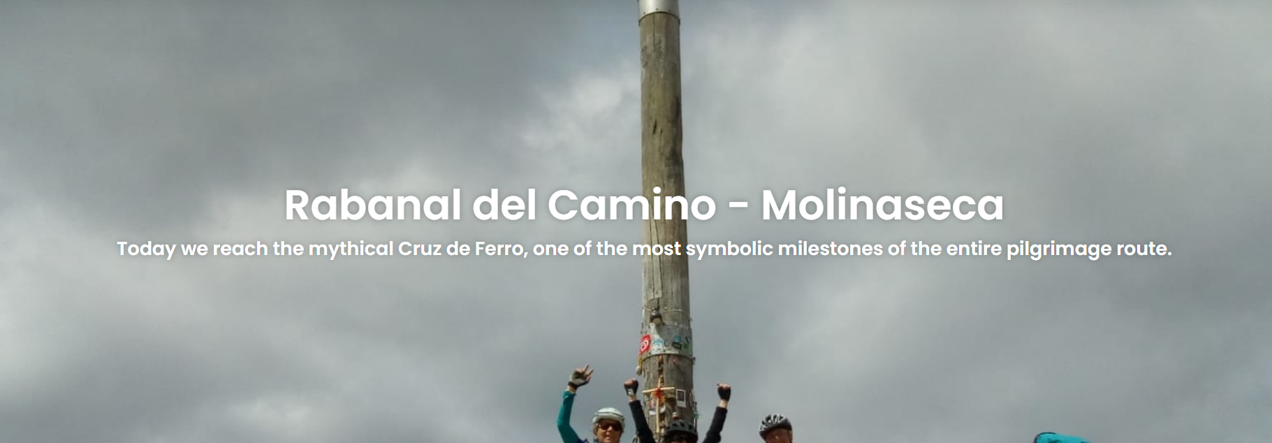
Day 26 | Rabanal del Camino – Molinaseca / Overnight Molinaseca
This stage from Rabanal del Camino to Molinaseca is one of the most iconic sections of the Camino. The route ascends to the sacred Cruz de Ferro (Iron Cross), where pilgrims traditionally leave a stone as a symbol of letting go of their burdens. It then descends through pine forests and mountain valleys, ending in the picturesque village of Molinaseca, nestled among the hills.

Today's Overview
- Route Difficulty: Moderate
- Walking Distance: 24.62 km
- Walking Time: 6 hours 40 minutes
- Total Ascent: 1,006 m
- Total Descent: 1,587 m

Recommended Route Stages
- Rabanal Del Camino - El Acebo San Miguel 16.4 km
- El Acebo De San Miguel - Molinaseca 8.2 km
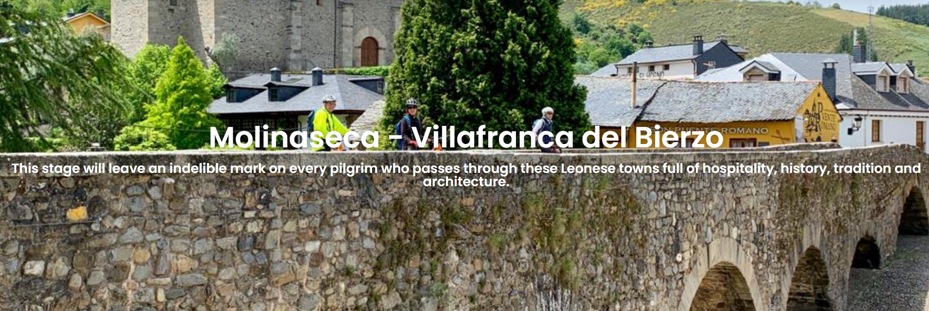
Day 27 | Molinaseca – Villafranca del Bierzo / Overnight Villafranca del Bierzo
This stage from Molinaseca to Villafranca del Bierzo offers beautiful and varied scenery. The route passes through the historic town of Ponferrada, home to the impressive Templar Castle, before continuing across the fertile Bierzo Valley, surrounded by vineyards, orchards, and peaceful villages. The day ends in the charming town of Villafranca del Bierzo, known for its stone bridges and ancient churches.

Today's Overview
- Route Difficulty: Moderate
- Walking Distance: 30.63 km
- Walking Time: 7 hours
- Total Ascent: 643 m
- Total Descent: 713 m

Recommended Route Stages
- Molinaseca - Camponaraya 16.8 km
- Camponaraya - Villafranca Del Bierzo 13.8 km
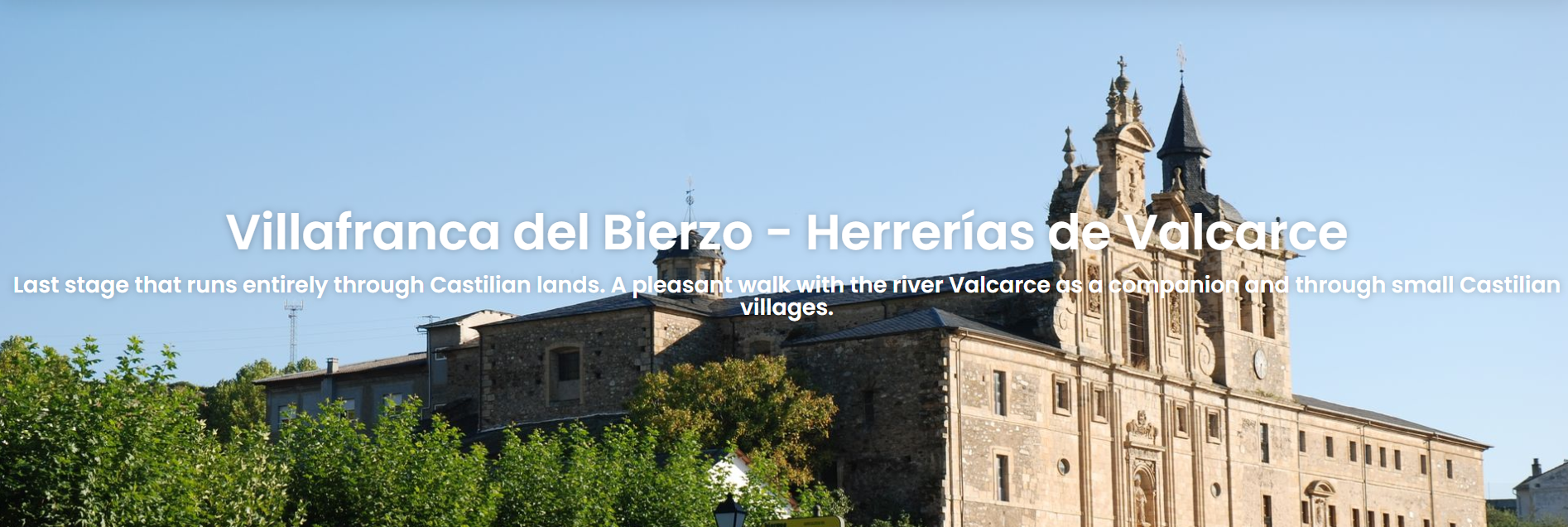
Day28 Villafranca del Bierzo-Herrerías/Ambasmestas / Overnight Herrerías or Ambasmestas
This stage from Villafranca del Bierzo to Herrerías or Ambasmestas features a gentle ascent through peaceful valleys and tree-lined country paths. Along the way, pilgrims can enjoy the pastoral landscapes and mountain views of the Bierzo region, making it a pleasant and tranquil approach before entering the hills of Galicia.

Today's Overview
- Route Difficulty: Moderate
- Walking Distance: 20.31 km
- Walking Time: 4 hours 20 minutes
- Total Ascent: 954 m
- Total Descent: 795 m

Recommended Route Stages
- Villafranca Del Bierzo - Trabadelo 9.9 km
- Trabadelo - Herrerias De Valcarce 10.4 km
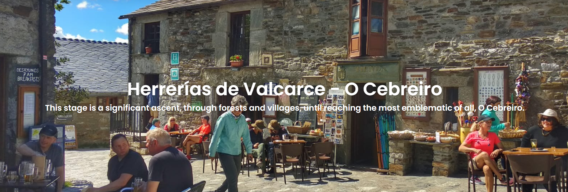
Day 29 | Herrerías / Ambasmestas – O Cebreiro / Overnight O Cebreiro
This stage from Herrerías or Ambasmestas to O Cebreiro is one of the most challenging yet breathtaking sections of the Camino. The route climbs steadily into the Galician mountains, offering sweeping views of the valleys and surrounding peaks. It culminates in the hilltop village of O Cebreiro, a charming medieval stone settlement famous for its traditional thatched houses and spectacular mountain scenery—an iconic milestone for every pilgrim.

Today's Overview
- Route Difficulty: Hard
- Walking Distance: 8.12 km
- Walking Time: 4 hours
- Total Ascent: 749 m
- Total Descent: 130 m

Recommended Route Stages
- Herrerias De Valcarce - A Faba 3.19 km
- A Faba - O Cebreiro 4.6 km
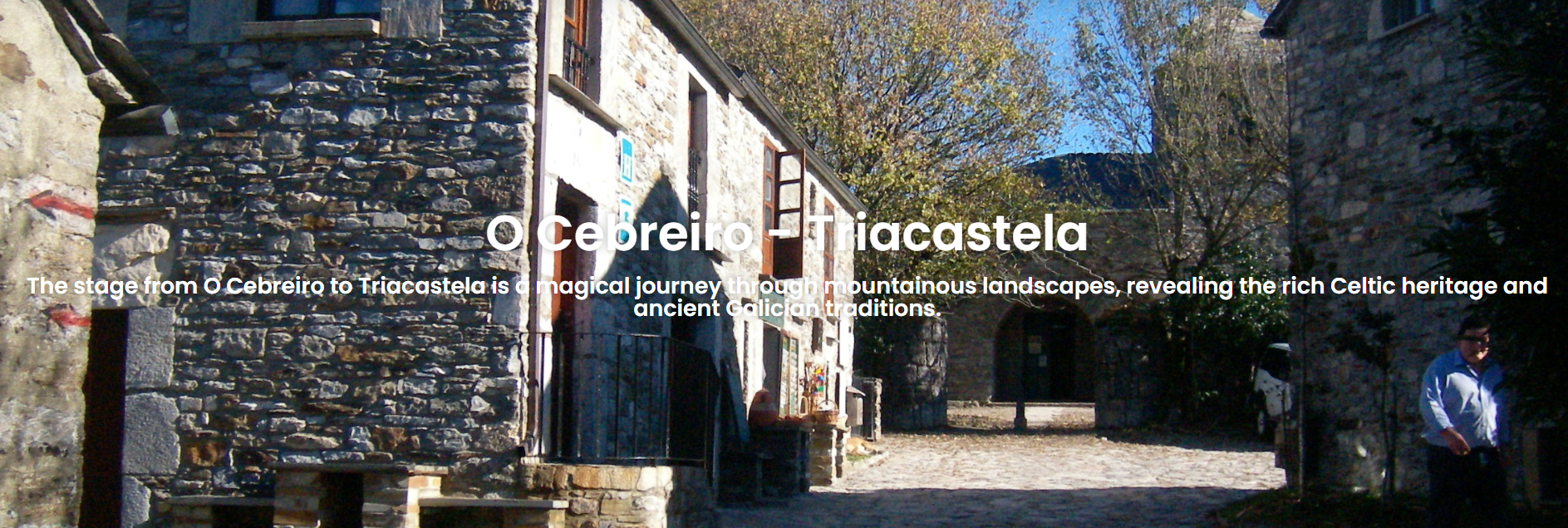
Day 30 | O Cebreiro – Triacastela / Overnight Triacastela
This stage from O Cebreiro to Triacastela showcases some of the most enchanting scenery in the Galician mountains. The route winds through rolling hills, green pastures, and misty villages, creating a tranquil and almost mystical atmosphere. Although there are a few steep sections, the path is mostly downhill, offering a peaceful and scenic journey that ends in the welcoming mountain town of Triacastela.

Today's Overview
- Route Difficulty: Moderate
- Walking Distance: 20.73 km
- Walking Time: 6 hours 50 minutes
- Total Ascent: 314 m
- Total Descent: 938 m

Recommended Route Stages
- O Cebreiro - Linares 3 km
- Linares - Alto De San Roque 1 km
- Alto De San Roque - Hospital Da Condesa 1.4 km
- Hospital Da Condesa - Padornelo 2.2 km
- Padornelo - Alto Do Poio 0.8 km
- Alto Do Poio - Fonfria 3.1 km
- Fonfria - O Buduedo 2.5 km
- O Buduedo - Triacastela 6.6 km
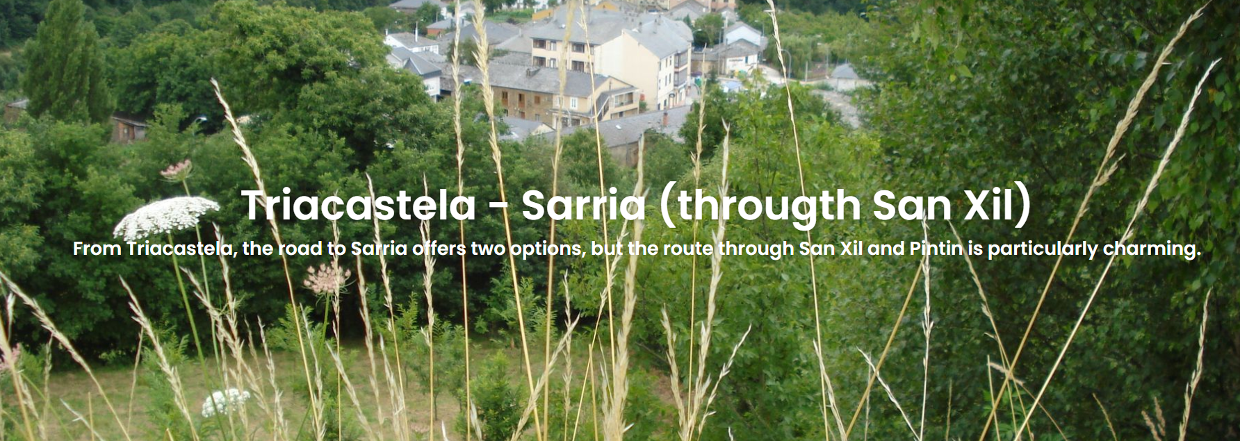
Day 31 | Triacastela – Sarria / Overnight Sarria
This stage from Triacastela to Sarria offers two main route options: one passes by the historic Monastery of Samos, known for its peaceful atmosphere and spiritual heritage, while the other winds through rural paths and charming villages, surrounded by beautiful countryside views. Whichever route is chosen, this day marks the approach to Sarria, the starting point for the final 100 kilometers of the Camino.

Today's Overview
- Route Difficulty: Easy
- Walking Distance: 17.52 km
- Walking Time: 5 hours
- Total Ascent: 549 m
- Total Descent: 765 m

Recommended Route Stages
- Triacastela - Montan 6.4 km
- Montan - Aguiada 6.5 km
- Aguiada - Sarria 4.7 km
Day 32 | Sarria – Portomarín / Overnight Portomarin
This stage from Sarria to Portomarín is a classic day on the Camino, winding through lush Galician countryside, traditional villages, and gently rolling fields. Upon reaching Portomarín, pilgrims can admire the town’s historic stone bridge and rebuilt churches, relocated due to the construction of a reservoir, adding a unique blend of history and culture to the journey.
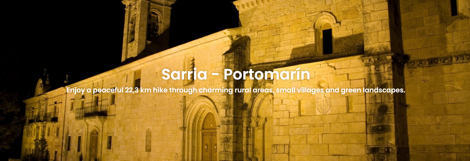

Today's Overview
- Route Difficulty: Easy
- Walking Distance: 22.31 km
- Walking Time: 5 hours 30 minutes
- Total Ascent: 753 m
- Total Descent: 857 m

Recommended Route Stages
- Sarria - Barbadelo 4.2 km
- Barbadelo - Morgade 8.1 km
- Morgade - Portomarin 9.7 km
Day 33 | Portomarín – Palas de Rei / Overnight Palas de Rei
This stage from Portomarín to Palas de Rei continues through the lush Galician countryside, passing small villages, forested paths, and gently rolling fields. The route is relatively flat and comfortable, allowing pilgrims to take a relaxed pace and enjoy the peaceful natural surroundings. Upon arrival, Palas de Rei welcomes visitors with its historic churches and traditional buildings, making it an ideal place for rest and resupply.
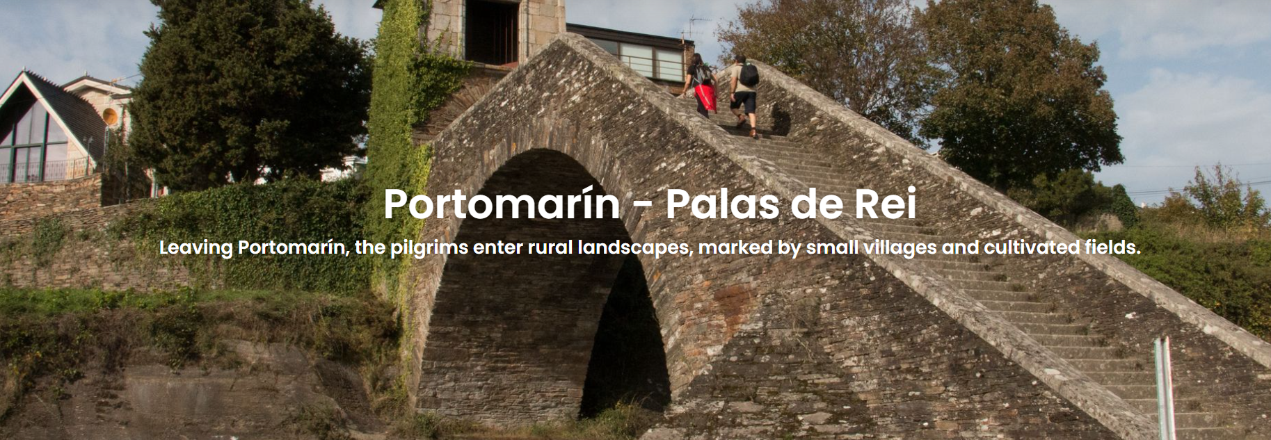

Today's Overview
- Route Difficulty: Moderate
- Walking Distance: 24.89 km
- Walking Time: 6 hours 30 minutes
- Total Ascent: 884 m
- Total Descent: 672 m

Recommended Route Stages
- Portomarin - Ventas De Naron 13.4 km
- Ventas De Naron - Palas De Rei 11.6 km
Day 34 | Palas de Rei – Arzúa / Overnight Arzúa
This stage from Palas de Rei to Arzúa passes through the green fields and forested paths of Galicia, occasionally crossing small villages and traditional farmhouses. The route has moderate undulations, allowing pilgrims to walk at a steady pace while enjoying the natural scenery and rural charm. Upon arrival, Arzúa is renowned for its cheese and offers an ideal place for pilgrims to rest, refuel, and experience local culture.
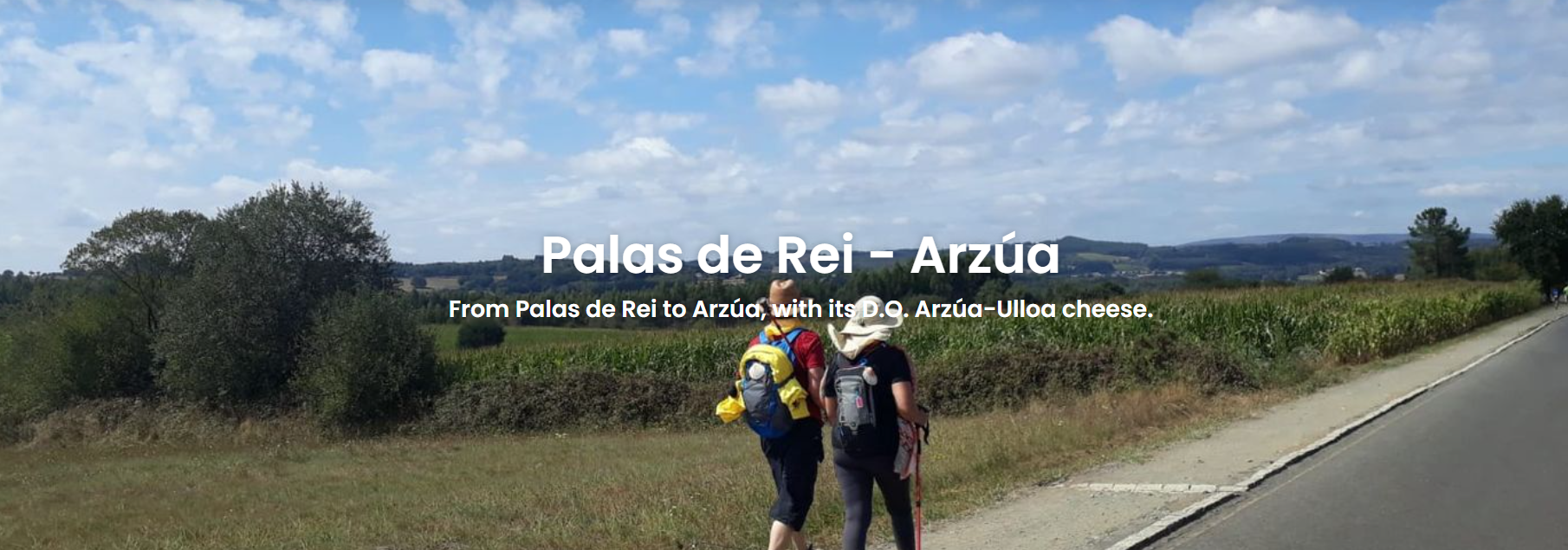

Today's Overview
- Route Difficulty: Hard
- Walking Distance: 28.57 km
- Walking Time: 7 hours
- Total Ascent: 685 m
- Total Descent: 852 m

Recommended Route Stages
- Palas De Rei - San Xulian Do Camino 3.5 km
- San Xulian Do Camino - Ponte Campana 1 km
- Ponte Campana - O Coto 3.7 km
- O Coto - Leboreiro 1.1 km
- Leboreiro - San Xoan De Furelos 3.7 km
- San Xoan De Furelos - Melide 1.4 km
- Melide - Boente 6.4 km
- Boente - Cantaneda 2.1 km
- Castaneda - Ribadiso 3 km
- Ribadiso - Arzua 3 km
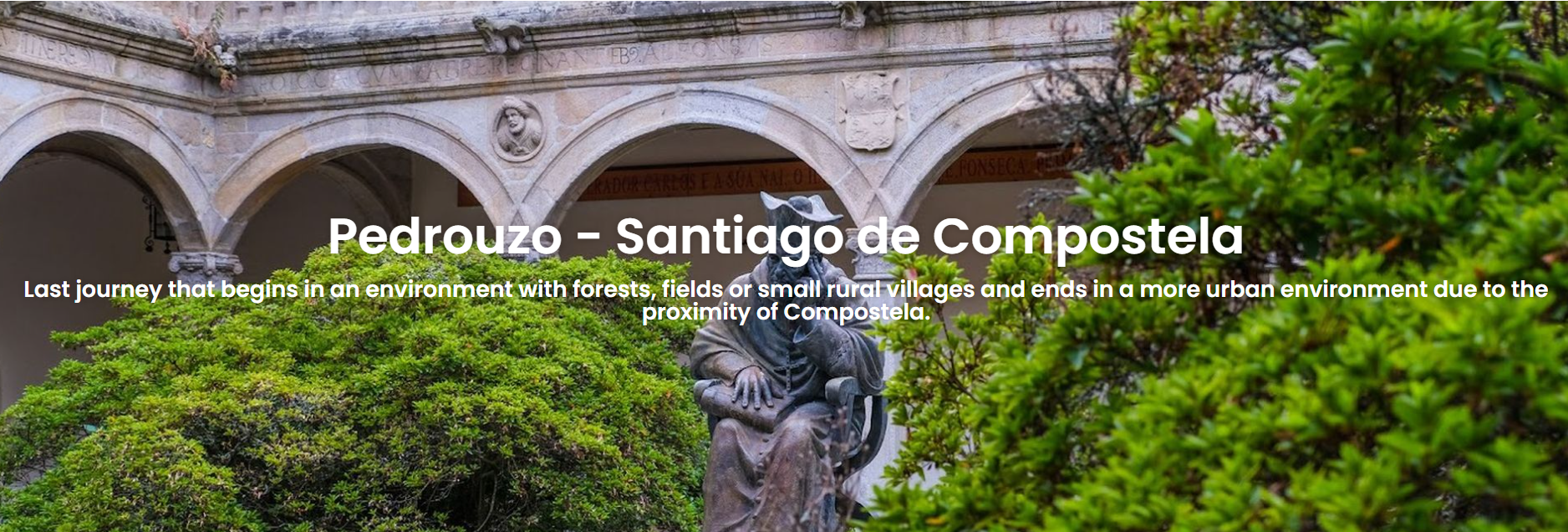
Day 35 | Arzúa – Rúa/Pedrouzo / Overnight Rúa or Pedrouzo
This stage from Arzúa to Rúa or Pedrouzo is a key segment as pilgrims enter the final stretch of the Camino. The route passes through Galicia’s gentle fields, pine forests, and rural paths, with some undulations but generally comfortable walking. Along the way, pilgrims can enjoy traditional farmhouses, clear streams, and lush greenery, offering a peaceful and scenic experience in the final days before reaching the holy destination.
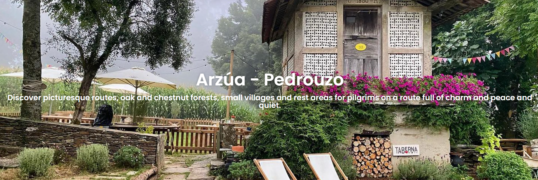

Today's Overview
- Route Difficulty: Easy
- Walking Distance: 19.33 km
- Walking Time: 5 hours 30 minutes
- Total Ascent: 480 m
- Total Descent: 581 m

Recommended Route Stages
- Arzua - A Calzada 5.7 km
- A Calzada - O Empalme 9.3 km
- O Empalme - Pedrouzo 4.3 km
Day 36 | Rúa/Pedrouzo – Santiago de Compostela / Overnight Santiago de Compostela
This stage from Rúa/Pedrouzo to Santiago de Compostela is the final and most symbolic segment of the Camino. The route mainly follows gentle country roads and forested paths, showcasing the typical green landscapes of Galicia. Upon arrival, pilgrims are greeted by the magnificent Cathedral of Santiago de Compostela, marking the completion of their journey and offering a profound sense of achievement and spiritual fulfillment.

Today's Overview
- Route Difficulty: Easy
- Walking Distance: 19.77 km
- Walking Time: 5 hours 28 minutes
- Total Ascent: 473 m
- Total Descent: 504 m

Recommended Route Stages
- Pedrouzo - Amenal 3 km
- Amenal - Lavacolla 5.9 km
- Lavacolla - Monte Do Gozo 5.3 km
- Monto Do Gozo - Santiago 5 km
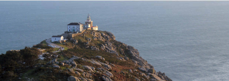
[Recommended Add-on] Fisterra Day Trip
Where does your Camino end?
Some may see Fisterra as the ultimate destination, but we believe your Camino never truly ends. You can walk the 90 km from Santiago, or join our guided day trip to give your feet a rest. Legend says walking nine times under a large arched stone here can heal all ailments.
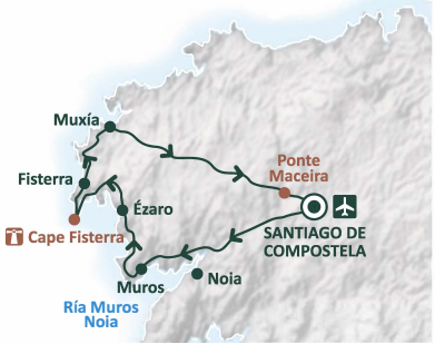
Trip Highlights
- Round-trip minibus transfer from Santiago
- Stunning, rugged coastline along northern Galicia
- Picturesque fishing village Muros
- Ezaro waterfall and Pindo Mountain views
- Sanctuary of Muxia
- Tasting of local Galician cuisine
Schedule
- Departure: 09:00 from Santiago
Included
- Round-trip bus transfer
- English/Spanish-speaking professional guide
- Add-on Price: €60 per person

Travel Duration


Travel route
FAQs
What about my luggage?
What should I have in my daypack while walking?
Shoe Tips
Clothing Tips
Rain Gear
Toiletries
Personal Essentials
Internet Access
Transport to Start & From Finish
Checked Baggage Policy
Pre-Departure Tips
Physical Preparation
Physical Preparation
Best training: walking—start about 3 months before your trip. Wear your pilgrimage shoes while training (avoid boots—they’re heavy and hot in summer; lightweight hiking shoes are ideal).
Tips for long walks: change your walking style often (zig-zag or occasionally backward) to engage different muscles, and rest, elevate, or massage your legs in the evening.